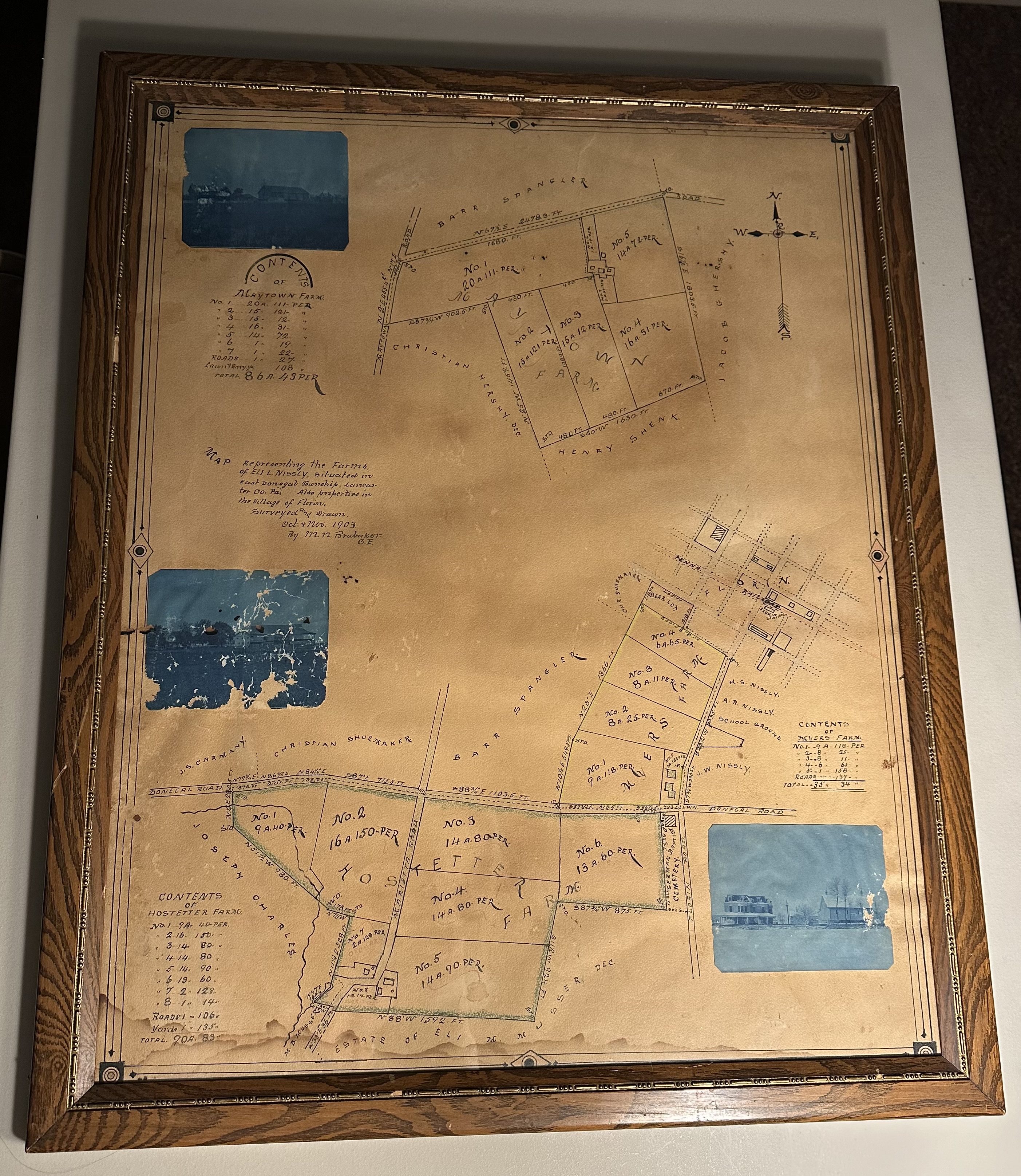
Framed Map of Farms and Properties of Eli L. Nissly 1903
Dublin Core
Identifier
2023.1
Title
Framed Map of Farms and Properties of Eli L. Nissly 1903
Subject
Agriculture
Town History
Map
Town History
Map
Description
Surveyed and drawn by M. N. Brubaker C.E., farms in East Donegal Township and properties in Florin
Date
October-November 1903
Creator
M. N. Brubaker
Physical Object Item Type Metadata
MJAHS Location
By Fireplace
Files
Collection
Citation
M. N. Brubaker, “Framed Map of Farms and Properties of Eli L. Nissly 1903,” MJAHS Online Inventory, accessed June 23, 2026, https://www.mountjoyhistory.com/inventory/items/show/12034.