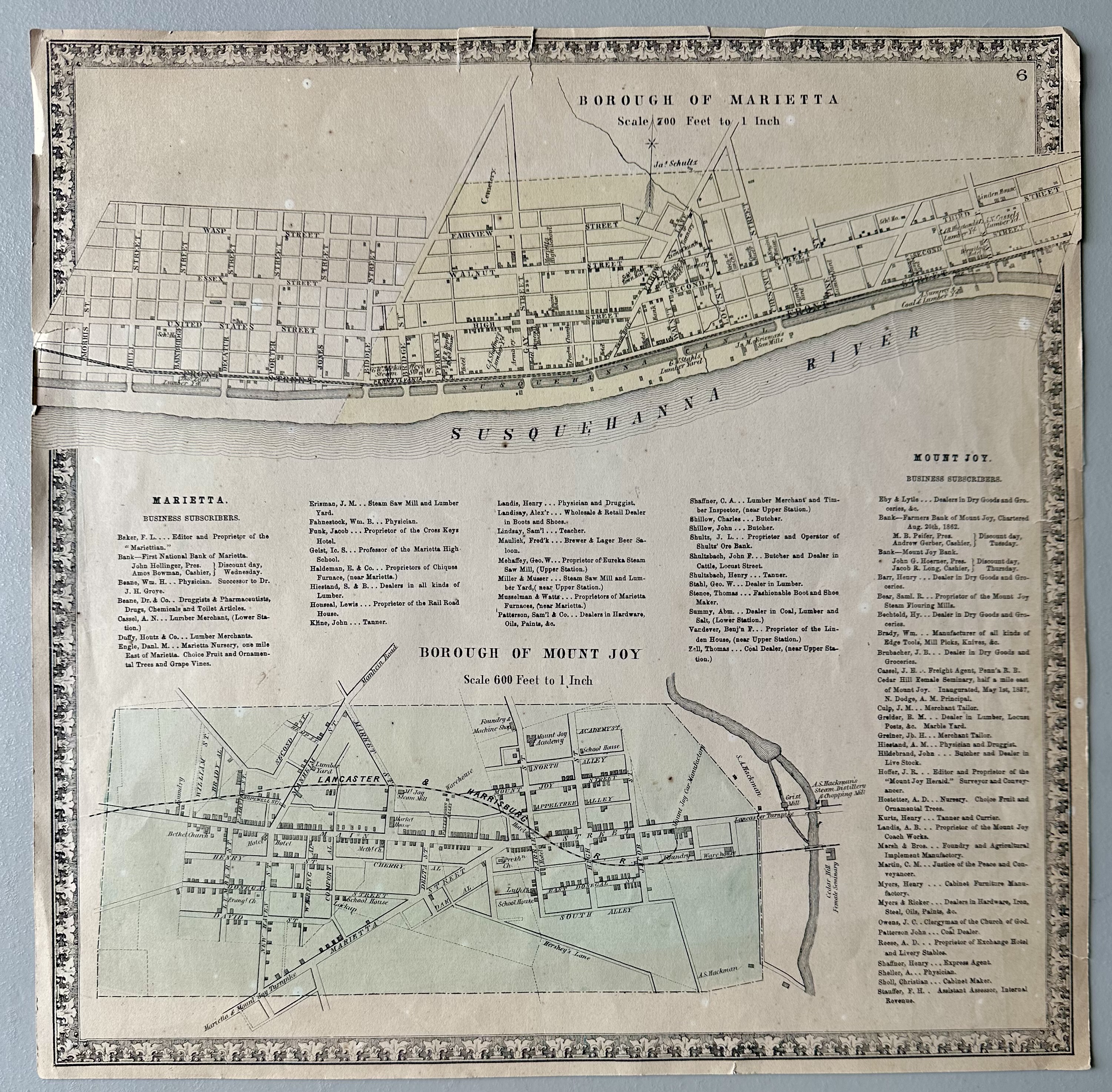
Map of Marietta with map of Mount Joy
Dublin Core
Identifier
2024.9.a
Title
Map of Marietta with map of Mount Joy
Subject
Town History
Description
Map of Marietta with map of Mount Joy, Eby Lytle, Farmers Bank of Mount Joy, M.B. Peifer, Andrew Gerber, Mount Joy Bank, John G. Hoerner, Jacob R. Long, Henry Barr, Samuel R. Bear, Bechtold, Brady, J.B. Brubacher, J.E. Cassel, Cedar Hill Female Seminary, N. Dodge, J.M. Culp, B.M. Greider, Greiner, Hiestand, John Hildebrand, J.R. Hoffer, A.D. Hostetter, Henry Kurtz, A.B. Landis, Marsh & Bros, C.M. Martin, Myers & Ricker, J.C. Owens, John Patterson, A.D. Reese, Henry Shaffner, Sheller, Christian Sholl, F.H. Stauffer, Mount Joy Herald, Church of God, Exchange Hotel,
Date
1860s
Files
Collection
Citation
“Map of Marietta with map of Mount Joy,” MJAHS Online Inventory, accessed June 15, 2026, https://www.mountjoyhistory.com/inventory/items/show/12407.